

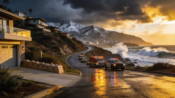
Los Angeles County emergency officials have put neighborhoods on alert for possible flooding and debris flows as a major atmospheric river storm heads for Southern California. The National Weather Service expects widespread rain and strong winds, along with large ocean swells and heavy mountain snowfall. The most intense rainfall is set to hit Los Angeles County by mid-morning Thursday. According to the National Weather Service Los Angeles/Oxnard Flood Watch, rain could fall at rates up to 1 inch per hour in the mountains, with the highest flood risk between 6 a.m. and 6 p.m. Thursday, November 19. The flood watch covers a broad area, including Downtown Los Angeles, Malibu, Pacific Palisades, Topanga, Calabasas, the San Fernando Valley, the San Gabriel Mountains, and other communities across the county.
Residents near recent wildfire burn scars-such as those affected by the Eaton fire in Altadena, the Palisades fire near Pacific Palisades, Malibu and Topanga, the Sunset fire in the Hollywood Hills, the Kenneth fire in Calabasas, the Hurst fire near Sylmar, and the Canyon fire near Hasley Canyon, Castaic, and Val Verde-have received direct warnings to get ready for possible evacuation. The alert is in effect from 6 p.m. Wednesday through 8 a.m. Friday, according to the county Office of Emergency Services. The National Weather Service points to flooding from excessive rainfall as the main hazard, with heavy flows possible in creeks and canyons, flooded roads, and water collecting in low-lying spots. Areas where recent fires have stripped away vegetation face a higher risk of debris flows.
Flood and Debris Flow Risks
The National Weather Service has issued a flood watch for Santa Barbara, San Luis Obispo, Ventura, and Los Angeles counties, with the Antelope Valley excluded. The warning area in Los Angeles County covers coastal, inland, foothill, mountain, and urban zones, including Santa Clarita Valley, the Santa Monica Mountains, Calabasas and Agoura Hills, the San Fernando Valley, the San Gabriel Valley, and the Interstate 5 corridor. Some locations, especially south-facing slopes and mountain areas, could see rainfall rates up to an inch per hour. Thunderstorms may develop, with a 20% chance of heavy downpours, lightning, and downburst winds. Coastal slopes and foothills could get 3 to 5 inches of rain, while other areas are expected to see 1 to 3 inches. Farther inland, totals may stay below an inch. The National Weather Service describes the incoming system as a weak to moderate atmospheric river on the front edge of a moving cold front, with the greatest flooding threat likely in a four-to-eight-hour window.
Officials urge residents to stay away from flood control channels, catch basins, canyons, and natural waterways that could flood. The state has activated its State Operations Center to coordinate emergency response, and extra resources are being staged near vulnerable communities. Local fire departments have prepositioned engines and swift water rescue teams. L.A. County Public Works crews have cleared 1.3 million cubic yards of sediment from debris basins and reservoirs this year to help manage storm runoff.
Storm Impacts and Preparedness
California Department of Transportation crews are reinforcing slopes, clearing drainage systems, and staging equipment like excavators and water pumps in flood-prone areas. District 7, which covers Los Angeles and Ventura counties, has two Vactor trucks ready to clear sewers and drains. Maintenance crews will work around the clock during the storm to address flooding on major roads.
Mountain regions are forecast to receive 4 to 8 inches of snow above 7,000 feet and 1 to 3 inches above 5,500 feet. The UC Berkeley Central Sierra Snow Lab has already measured about 35 inches of snow this season, which is 190% of the median. The storm could add another 2 to 4 feet of snow through early Friday morning, further increasing the snowpack that supports California's water supply.
Coastal Hazards and Future Weather
Large ocean swells and gusty winds are expected to create dangerous conditions along the coast, with a high surf advisory in place through Friday. The biggest waves are forecast for west- and northwest-facing shores, threatening harbors and piers in Morro Bay, Ventura, Pismo Beach, and Cayucos. Coastal flooding and significant erosion are possible, especially during Thursday morning's high tide. Roads and structures along the Central Coast could also be affected, as detailed in a reported earlier.
In the future, forecasters see a chance of more rain on Sunday along the Central Coast, with up to a quarter-inch possible. Another storm system could arrive next Tuesday or Wednesday, though its size and impact are still unclear. Extremely high tides are forecast for next week, and more ocean swells may develop during that period.